July 11, 2024 – Along the Mill Brook
This is my 70th trip around the sun and my 30th year residing along the Mill Brook. Over these past three decades, I have observed this efficient watershed that drains Mount Ellen, General Stark, Baby Stark, and Molly Stark Mountains. Along with Camel’s Hump to the north, these make up the Green Mountain Monroe Skyline. As you can imagine, the Mill Brook has a dynamic personality. Yesterday, Beryl, a former hurricane that ravaged the Caribbean, took a broad reach through the continental U.S., picking up some more moisture from the Great Lakes, then headed east in a beeline to Vermont, where it dropped several inches of rain in a few hours. The rain began in the early afternoon. The Mill Brook, a great repository for this copious rain, was in full rage by 9:00 pm.
Set back from the brook about 100 feet and elevated about 12 feet above, my home has a great view of it. Sound also emanates constantly, now at a high din, often a soft mur or trickle. This has been an idyllic setting for me to live through 30 seasonal changes. The view also provides an intimate natural laboratory to observe the hydrologic proclivities of the Green Mountain tributary to the Mad River. As a regular weather radar watcher (most ski bums are), I watch the colorful display in motion, anticipating the results and calibrating my observations; I have concluded that the climate is changing in front of our eyes and ears. One cannot deny the observational data that we are getting a shit-ton more rain.
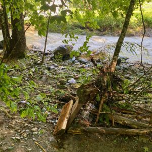
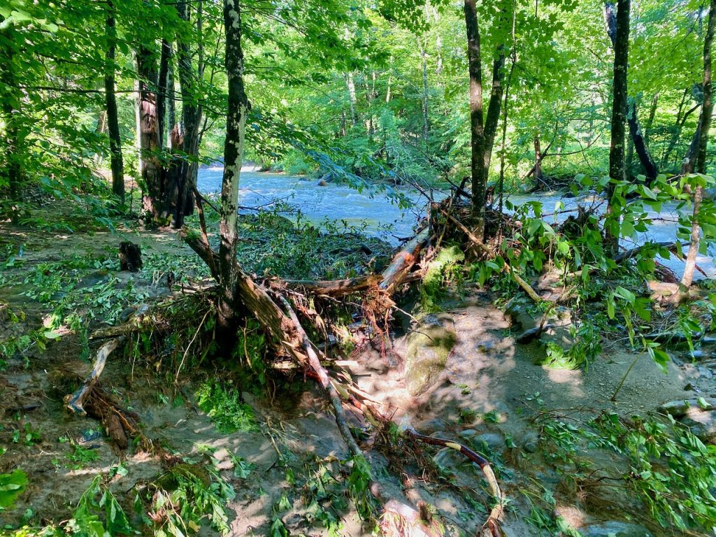
Since I have lived here, there have been two 50-year flood events in the Mad River Valley, June 1998 and August 2011- Irene, the Bitch. Even though the Mad River did not flood the village of Waitsfield yesterday, the Mill Brook exceeded the 1998 level and equaled the 2011 event. Walking the riparian zone this morning, I observed a debris line that proved the value of the floodplain. Ironically, I did not see the inundation as I was in full REM, lulled to sleep before midnight by the roar of rain on my metal roof and the raging Mill Brook.
The factor that causes the most destruction is the volume of rain per hour. Yesterday, the rain came in solid sheets at a rate of 3 inches an hour. We rejoice when it snows more than 2″ per hour. Much of this rain falls 3,000 feet above the Valley along the Green Mountain ridgeline and descends via the mountain brooks and streams. Gravity is a force upon this. The speed of the water is increased by the volume of water. Yesterday, it was scarily fast. Logs and debris whizzed by in the grasp of the torrential serpent. Its color was dark chocolate with foamy cream-colored plumes. Well above the rocks, the fast water made an eerie sucking sound, accompanied by the constant banging of the larger boulders clashing under the current. This was more than liquid moving. I could feel the collisions and a constant vibration of the ground under my feet near the banks as the fast morass fled from the high ground.
In the winter, the Mill Brook is another thing. If we are lucky, it will freeze over so that we can cross-country ski across to the schoolhouse yard on the other side or ski up the brook to the local tavern. Every day is a different day; the next will be warm, and the thaw will begin. Heavy rain and warm temperatures in the winter can cause the brook to experience an ice-out flood event. First, you feel it. Next, you hear it; then, when you reach the window, you can see it. Upstream, the trees along the bank are waving. The wall of ice chunks bounces off of them as the brook pukes its contents along the shore. As the huge surge passes by, the power is felt through the legs. Seeing, hearing, and feeling this power of nature so close causes the visceral responses of shaking knees and prickling hair follicles.
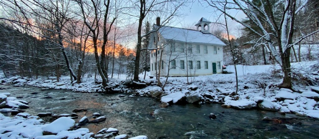
My property is a pressure relief valve for the brook. My house is up on a hill and out of harm’s way. The lower riparian zone along the brook is a floodway and floodplain. The floodway, a small auxiliary channel, is first activated. The excess water exits below back into the mainstem before the highway bridge, leaving a slim island of brookside trees. When the brook is at its highest, my lower lawn is inundated and becomes a temporary floodplain. This relieves any flooding on the opposite side, where the Number Nine Schoolhouse has been flood-free since 1903. Yesterday, the water was at the very top of the opposite bank. When will there be an event that will exceed that, I wonder?
Rainfall rates are one indicator of change in the Green Mountain climate. Invasive species, tree diseases, and pest infestations are all observable effects here. Knottweed, honeysuckle, purple loosestrife, chervil, etc., overtake our native plants, undermining soil stability. The emerald ash borer is killing our ash trees, bark disease is killing our beach trees, and the white pine is facing a similar demise due to the complex effects of the warming planet. Black fly and deer fly seasons that last longer vex the avid outdoor Vermonters. Oh, the price we are now paying for our overabundant and affluent lifestyles. ‘Yes, Virginia, there is no Santa Claus.’
Too much, too fast, perhaps the parable here. These are events that seem to be happening more and more in Vermont. Will your valley be the next one to be hit with a train of thunderstorms? One year ago, the neighboring Capitol City of Montpelier experienced another serious flood of the Winooski River. We, in our Valley, were spared. Nature acts in strange ways along the Mill Brook. Observations continue to fascinate me. As I while away my days along the Mill Brook, I will keep you posted.