July 17, 2024 – Phen Basin, Vermont
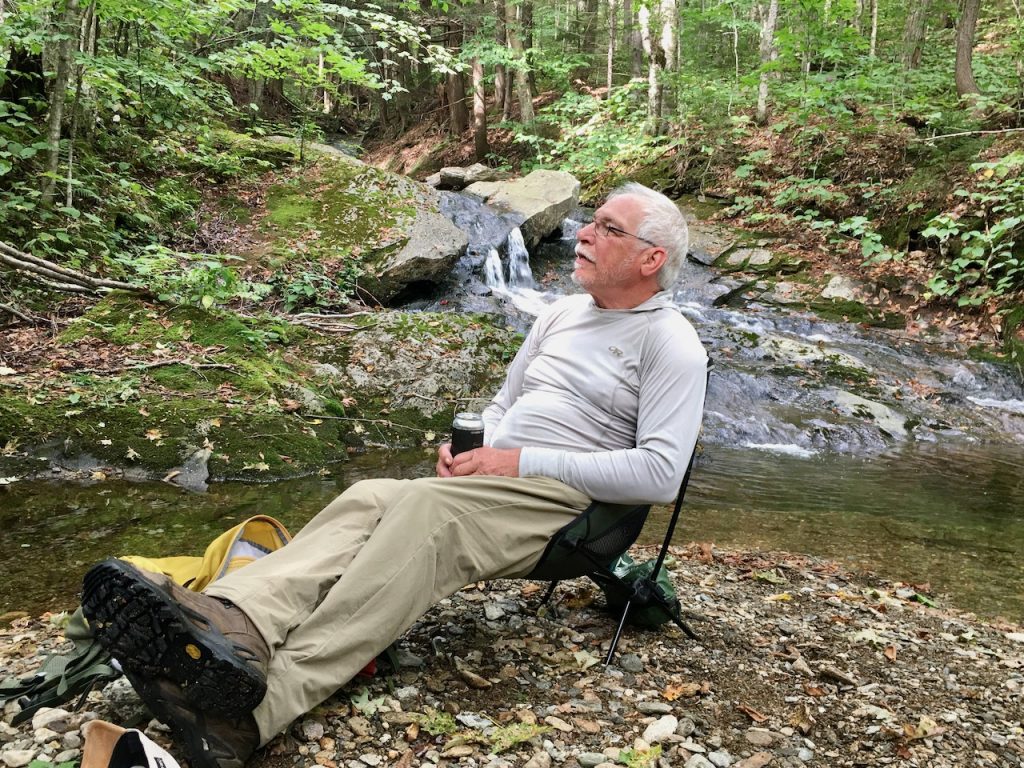
My living room is not your average indoor climate-controlled space. In fact, it is outdoors, the Phen Basin Wilderness Area of the Camel’s Hump State Park in Vermont. I do not own this room but have lived in it as often as possible since discovering it in 1999. I also work there, maintaining the Old Mountain Road that extends into the beautiful forest, now known as the Hemlock Hill Trail. The road, 20 feet wide from the ditch on the uphill side to the shoulder on the downhill, was the main corridor that once served the area’s logging operations long before Mill Brook Road was improved and connected over the Appalachian Gap.
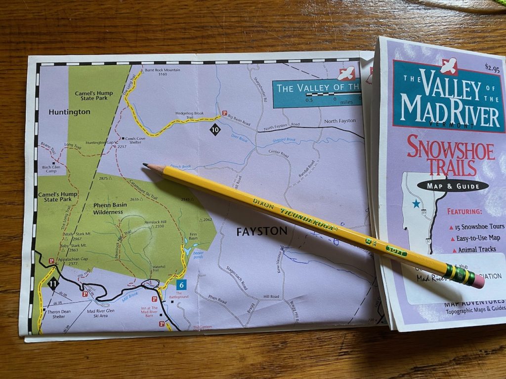
This name, Hemlock Hill Trail, was applied to the road by Betsy Pratt, then owner of Mad River Glen and the Mad River Barn. She assisted Map Adventures, a trail map production company, in creating one of the Valley’s first true GPS-base trail maps, The Valley of the Mad River Snowshoe Trails Map and Guide, published in 1997. This name is in reference to the prominent peak that overlooks the trail, Hemlock Hill, on the USGS map. The trail was also known as the “nettles road” by local bicycle enthusiasts who had informal permission from the previous private landowners, beginning with Ward Lumber Company. Old Mountain Road is the name of the road found on the oldest map in the Fayston Town Records, which also notes a logging camp at the end of the road. This was the main truck route into the well-maintained hardwood forest of which the Valley is known for. A local sawmill is still operating at the bottom of the Mill Brook in Waitsfield.
The 1997 snowshoe trail map also notes, shaded in green, the area recently conserved by a large group of public and non-profit organizations named Phenn Basin Wilderness. This land in south Fayston is contiguous to and officially part of the Camel’s Hump State Park as of 1995. The Hemlock Hill Trail goes directly into the Wilderness from Mill Brook Road, just uphill from the private High Falls Road. You will need to look carefully for the sign to the right as you go uphill. You can park parallel along the shoulder of the road, well off the pavement. This is the only location where the state land connects to Mill Brook Road, as all other parcels along the road have been developed for residences. This trail not only has the historical provenance as the original mountain road that goes up from Waitsfield, but it has a storied past of as a trail that fell and rose in the year 2,000.
I was introduced to this trail the year before by an avid off-road bicycle rider. I was an avid trail runner. It became my favorite run, being a moderate but consistently uphill wide triple-track, two created by the former trucks and one up the middle created by the bicycles. With a sustainable but rigorous pace, moving deliberately through the beauty of the straight hardwood trees that vault straight into the sky above me, I would rise into the heart of the wilderness. Once at the Oven Door Bridge, the second stream crossing one mile from Mill Brook Road, I would turn and descend, fully charged by endorphins. With high back kicks, my pace would quicken as I descended. I would soon reach the main road with sparks flying off the back of my sweat-soaked shirt. Quickly returning home to the Mill Brook, I would immerse myself in the cool (cold) waters of the swim hole to wash away the humanness and natural irritants such as the deer fly bites and nettle stings.
Then came the fateful day in early September 2,000. I had decided to go up and run the trail/road during lunch. When I arrived at the trailhead, I discovered the entrance to be obliterated with fallen trees. I heard chainsaws and the sound of heavy equipment up the trail. I noticed the tracks in the soil and logs that were placed in a pile. When I dove into the forest to bushwhack around the debris, I ran into Chuck (name on his hard hat) from the Vermont Forest Parks and Recreation. I said something like, “Chuck, WTF?” His reply was, “We’re buttoning it up.” like he meant the road. “We got this letter from the Vermont Land Trust about the illegal bicycling that has been going on, so we are buttoning it up.” Bear in mind that mountain biking was not a legally allowed activity on Vermont State lands in 2,000.
The bicycle user group had no voice in the easements that were applied to the purchase of the private land by the conservation partners. Other trail groups, including the Green Mountain Club, Catamount Trail Association, and Mad River Ridge Runners (snowmobiles), were written into the dedicated easement for the permanence of their trails through the newly acquired State land. The decision to take the Old Mountain Road out of service because of bicycling, now lost to the pedestrian, trail runner, and skier, was, in my mind, too over-reactionary. One mile of cut trees and deep-dug trenches across the 100-year-old legacy corridor and removing two important bridges was, well, a bridge too far for me and others.
I initiated a local outcry by contacting important local stakeholders. I also communicated with the office of Governor Howard Dean and enforcement officers at the Agency of Natural Resources, as well as the regional media outlets. Lo and behold, it was an election year, and the Commissioner of Vermont Forest Parks and Recreation met with me and others on Saturday, Labor Day weekend. We walked to a location just up the road through the tangled dropped trees and deep trenches to a point where we stood on a large boulder placed in the former road by the heavy equipment. As we stood on the rock, the Commissioner asked, “What would you like us to do?” We answered, “We would like our trail back and work with you on a long-term management plan for the Phen Basin, with the hope of including bicycle use.” The Commissioner replied, “We will rebuild this trail.” I call this rock, now pushed off to the side of the trail again, Reconciliation Rock.
Within ten days, the trail was reestablished, albeit without the bridges and clearly not made for bicycles, as the culverts had been replaced by broad-based water bars, some with running water. This, however, was a watershed moment for bicycling on Vermont State Land. The long-term management plan process included a robust public process. At that time, the local Mad River Rider (MRR) bicycle club became a managing partner for legalized bike trails on State lands outside the Wilderness area. Working closely with State Foresters, the MRRs have developed an extensive network of sustainable, well-managed trails that are multi-use in parts of the Camel’s Hump Management Unit throughout the Valley. They were the vanguard in the now very good working relationship between the Vermont Mountain Bike Association and the State of Vermont statewide.
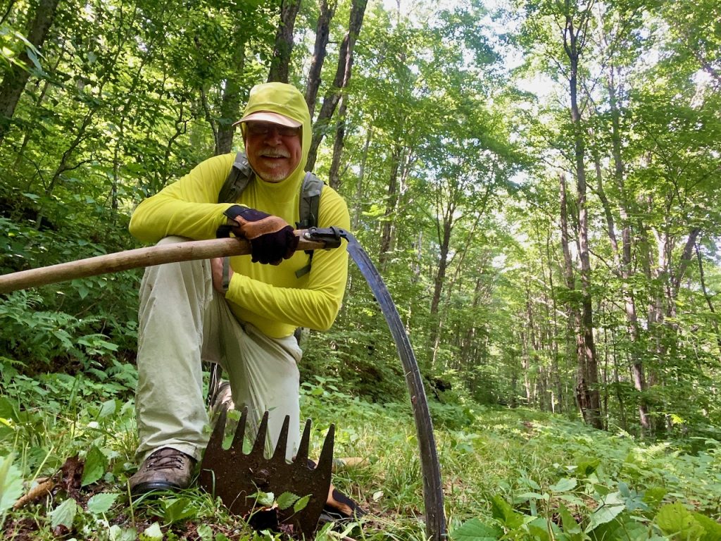
As far as the Hemlock Hill Trail, it retained the bicycle prohibition as it was in the designated Ecological Protection Zone established in 1995 as a condition from one of the conservation partners. I decided that since I made such a stink about this trail, I should step up and contribute my time to keep it in service for hiking and skiing. I learned that keeping the ditches and water bars clean of debris was paramount. I also soon discovered Mother Nature’s very deliberate and obvious plan to reforest the trail as soon as possible. I now mow the original profile of the road from ditch to shoulder every three years with a hand scythe (think Grim Reaper). I try to mow at least one five-foot lane up through the nettles every summer. In addition, keeping the trail clear of debris, Lopping offending limbs, cutting small trees that propagate along the outer shoulder, and filling in washouts are constant activities as I enjoy my regular visits to my living room. Keep in mind that the stick is the enemy of the ditch. Please throw sticks to the downhill side of the trail and not in the ditches. Mother Nature puts plenty in them already.
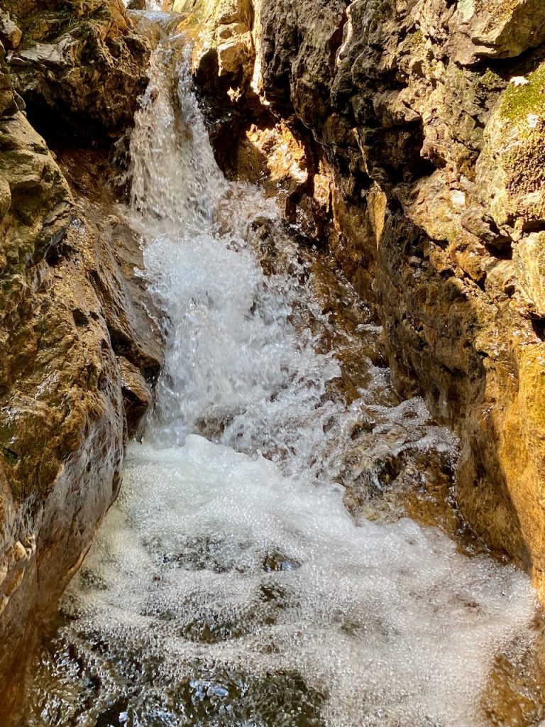
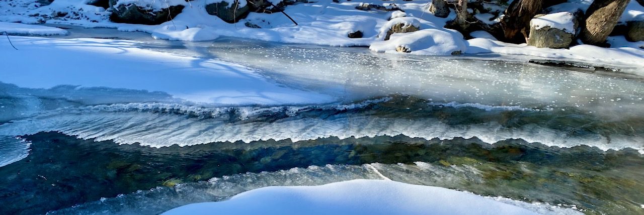
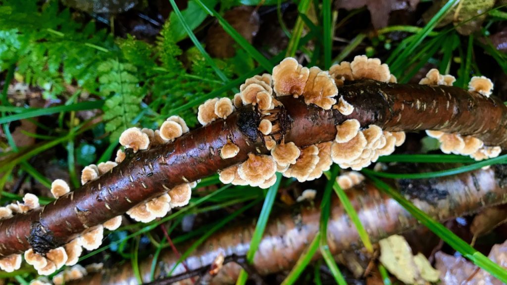
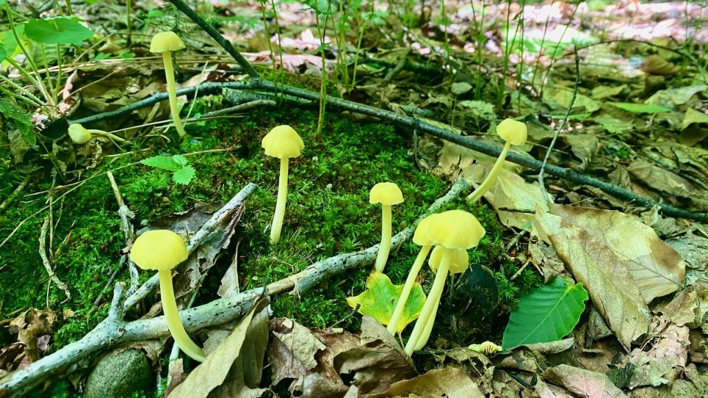
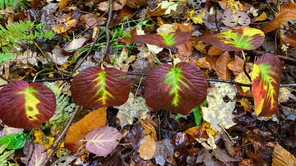
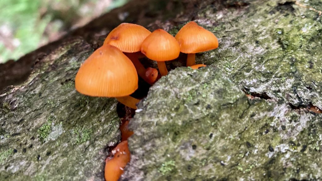
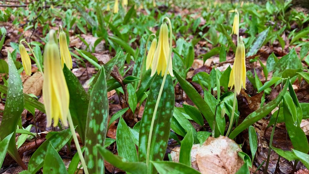
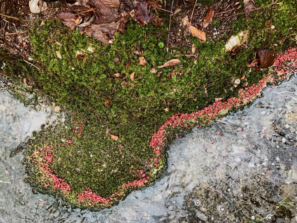
A real value of this gem into the wilderness is its social ability to walk together in small groups, two and three abreast, as it is 15-20 feet wide. Though it does not take you to a breathtaking summit, it does introduce you to some very cool local views. Venturing beyond the trail along the brooks will impress you with dramatic ledges and waterfalls and delight you with cool freshwater pools to take refuge from the flies that pester your ears and hair and bite. Your observant eyes will find many forest delights, including the various wildflowers, mosses, mushrooms, and ferns that transition through the warm seasons. You should not be surprised to find the prints of moose, bobcats, deer, and other critters in the mud or snow. The thrushes twirl the melodic sound through their gullets in serenade as you descend slowly in the evening twilight. During cold winter days, the Phen Basin is a warm refuge from the lift-served ski areas that are in view along the Green Mountains to the south. There is never a bad day on the Hemlock Hill Trail. Enjoy.